home
photos
details
capileira
planning
travelguide
contact
registry
bestman
chat
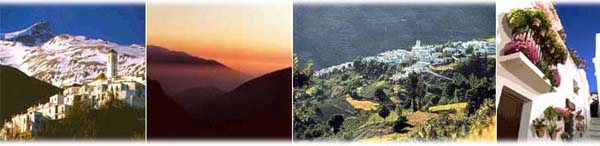
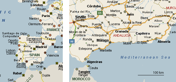
Capileira is a small village in the heart of the Alpujarras region in Andalucía. It hugs the slopes of a mountain valley, the Poqueira gorge, at 1436 m (4700 ft) above sea level, beneath the Sierra Nevada range and Mount Mulhacén, Spain's highest peak (3481 m). It is 70 km (45 mi) southeast of Granada by road, and about 60 km (37 mi) northeast of the beaches at Motril and Salobreña on the Costa Tropical.
Staying the night in Capileira
The village has a large number of guest houses and a three-star hotel. Please e-mail us with your arrival/departure details and requirements, and we will make a reservation for you. Some options:
- The 3-star Finca Los Llanos in Capileira (+34 958.76.30.71, Ctra. Sierra Nevada)
- Rustic Blue, +34 958.76.33.81, have vacation rentals in and near Capileira
- There are many other guest houses and hostels in town (including the Mesón Poqueira, site of the reception), at about €30/night for a double (€36 with a balcony).
Getting to Capileira
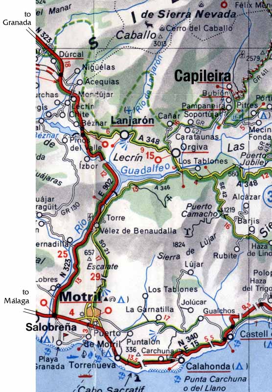
There is bus service from Granada to Capileira leaving from the main bus station, 3 km northwest of the center on the Carretera de Jaén (taxi or bus number 3 from the Gran Vía). Departures are at 10:30, 12:00, and 17:15 (please verify with the bus company Alsina Graells Sur, +34 958.18.50.10). Returns from Capileira at 6:20, 15:45, and 18:15. (3 hours)
But the easiest way to get there is by car:
From Granada, take the N323 highway in the direction of Motril (south). After 38 km, take exit 164 east on the A348 for Béznar, Las Alpujarras, and Lanjarón. Follow the signs to Lanjarón (6 km from the highway) and continue through towards Órgiva. Just as you enter Órgiva (15 km from the highway), turn left onto the GR421 in the direction of Bubión. Follow this through the villages of Carataunas and Pampaneira. Soon after Pampaneira (16 km from Órgiva) turn left onto the GR411 towards Bubión and Capileira. The village is 4 km up this road. (about 80 min)
From Málaga, take the coastal highway (E15/N340) in the direction of Motril and Almería (east). After the highway ends, continue through the towns of Nerja, La Herradura, Almuñecar, and Salobreña. About 2 km beyond Salobreña turn onto to the N323 in the direction of Granada (north). Take the second exit off the N323 (right, after 15 km) in the direction of Vélez de Benaudalla / Las Alpujarras, crossing a stone bridge (this exit comes 4 km after the first exit, also marked for Vélez de Benaudalla). After the bridge turn left onto the A346, following the sign for Órgiva. After a small tunnel (12 km from the bridge) make a left over another bridge towards Órgiva, visible uphill. Just before leaving Órgiva (about 3 km from the tunnel), turn right on the GR421 in the direction of Bubión, and continue as above. (about 2.5 hrs, though note that summer traffic is often heavy on the coastal road. An alternate route is to take the inland highway from Málaga via Granada, about 40 km longer, but highway nearly the entire way)